


Photo & Video Log
This page contains photos and videos taken during the 2003 Submarine Ring of Fire expedition that took place from February 9 to March 5, 2003. Click on any image to view a larger version and for additional information. ![]() If a picture of a movie camera camera icon is present, a QuickTime video can be viewed by clicking on the image. Other video formats may be available on the linked pages.
If a picture of a movie camera camera icon is present, a QuickTime video can be viewed by clicking on the image. Other video formats may be available on the linked pages.
(HR) = "High Resolution" images available.
 Video
Video
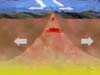
![]() Summary
Summary
Mid-ocean spreading center (mp4, 1.9 MB)
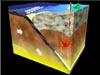
![]() Summary
Summary
Subduction Zone plate boundary (mp4, 1.3 MB)
![]() Feb 24
Feb 24
Panorama of Maug caldera (mp4, 510 KB)
![]() Feb 22
Feb 22
Hydrophone animation (Qmp4, 2.8 MB)
Images
Summary
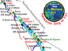
Bathymetry data collected at the Mariana Arc (HR)
Summary
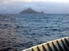
Farallon de Paharos Island (HR)
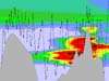
Summary
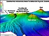
Bathymetry of three volcanoes (HR)
Summary
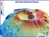
Bathymetry of West Rota submarine volcano (HR)
March 19
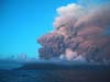
The Anatahan Volcano erupted on May 11, 2003.

March 19
The Anatahan Volcano erupted on May 11, 2003.
March 19
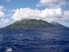
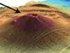
Anatahan Volcano as it appeared 3 months before the eruption.
March 19
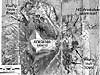
Map of MR1 sidescan sonar imagery around Anatahan island.
March 19
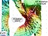
Map of EM300 multibeam sonar bathymetry around Anatahan island.

March 2
Kasuga 1 submarine volcano (HR)
March 2
Nikko submarine volcano (HR)
March 2
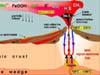
Venting system on a submarine arc volcano (HR)
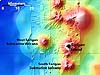
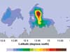
March 2
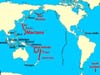
Distribution of active marine volcanic arcs (HR)
Feb 26
Securing the cups to the CTD frame

Feb 26
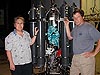
The backpack buddies with decorated cups

Feb 26
The backpack buddies surrounded by cups
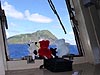
Feb 26
The backpack buddies enjoying the scenery (HR)
Feb 24
Profiles of chemical and physical tracers (HR)
Feb 24
Location of the CTD cast in the Maug caldera (HR)
Feb 24
The Thompson surrounded by Maug's three islands (HR)

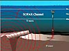
Feb 24
Autonomous Underwater Hydrophone (AUH) mooring (HR)
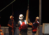
Feb 22
Deploying the hydrophone (HR)
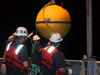
Feb 22
Deploying the syntactic foam float (HR)
Feb 18
Plumes near East Diamante volcano (HR)
Feb 17
Submarine volcano map (HR)
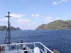
Feb 17
Sarigan Island (HR)
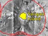
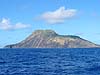
Feb 17
Sarigan Island from the MR1 survey (HR)
Feb 17
Towfish being recovered (HR)
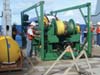
Feb 17
MR1 sonar system (HR)
Feb 12
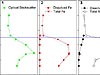
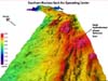
Southern Mariana back-arc spreading center (HR)
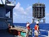
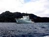
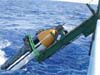
Feb 12
G. Lebon and S. Maenner launch the CTD (HR)
Feb 12
Location of hydrothermal vent fields (HR)
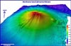
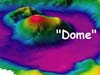
Feb 12
Northwest Rota submarine volcano (HR)