Beyond the Blue: Palau Mapping
(EX2505, EX2506, EX2507)
Dates
July 22-August 1
August 18-September 11
September 19-October 8
Vessel
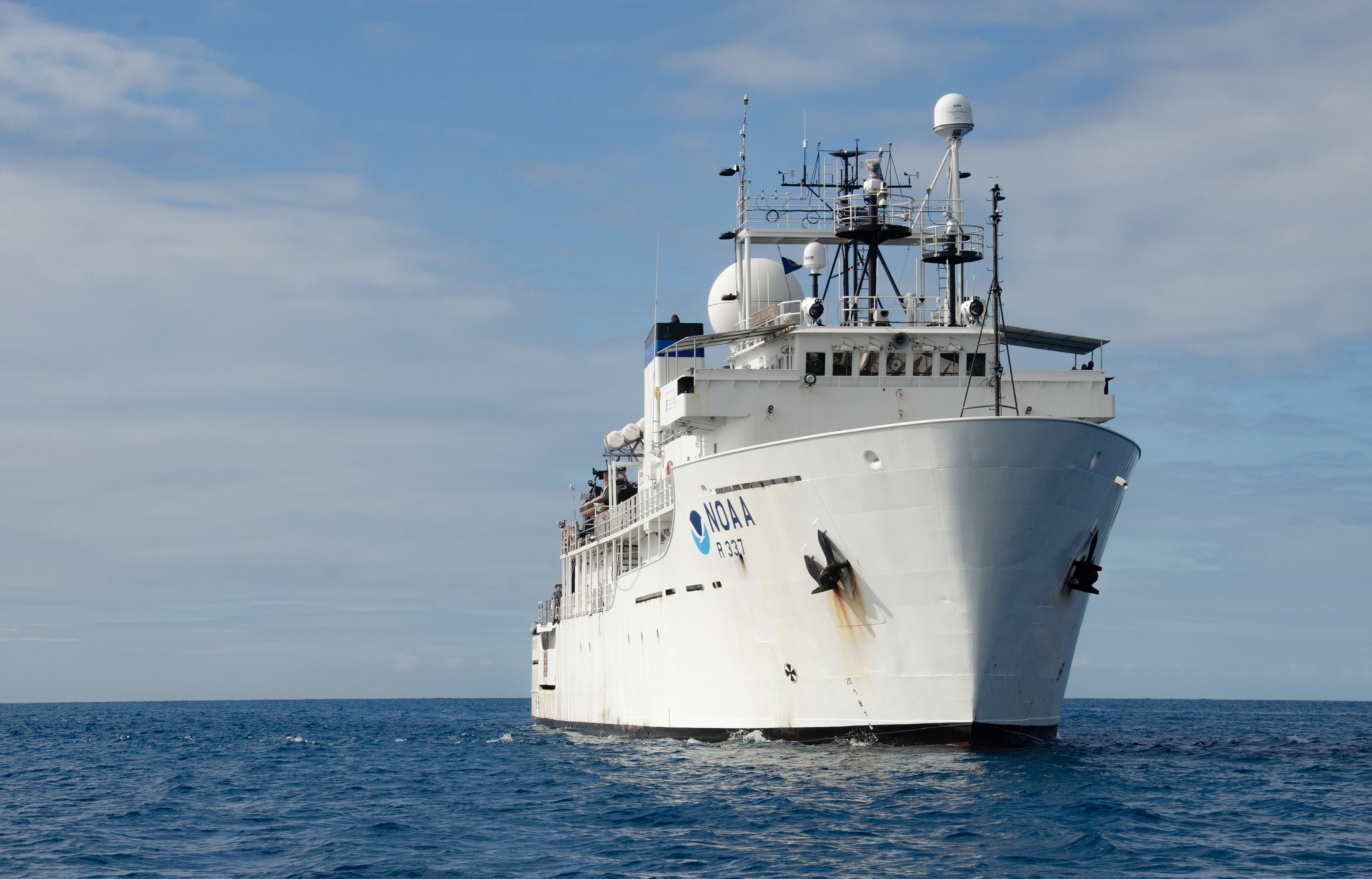
NOAA Ship Okeanos Explorer
Location
Pacific Ocean: Deep waters off Palau
Primary Goal
Increase mapping coverage in unexplored areas of Palau National Marine Sanctuary, with a focus on waters deeper than 200 meters (656 feet)
Primary Technology
Multibeam sonar
Preview of Expeditions
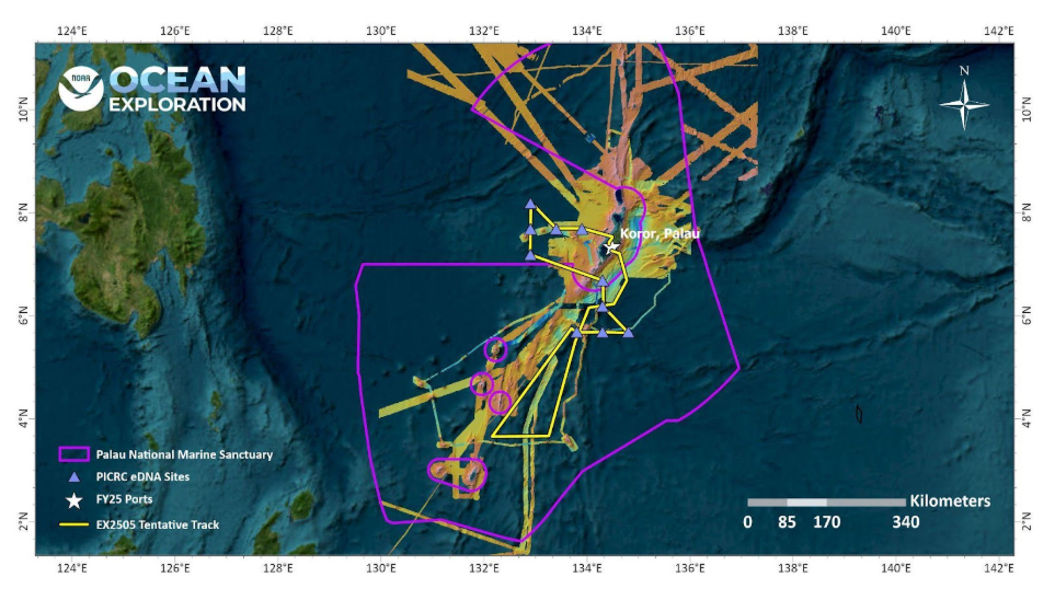
From July through October, NOAA Ocean Exploration will conduct three exploration mapping expeditions on NOAA Ship Okeanos Explorer in waters of Palau. Honoring the commitment the United States made to Palau in 2022, NOAA is working with the Palau International Coral Reef Research Center (PICRC) to collect high-resolution mapping data over a large area of the Palau National Marine Sanctuary.
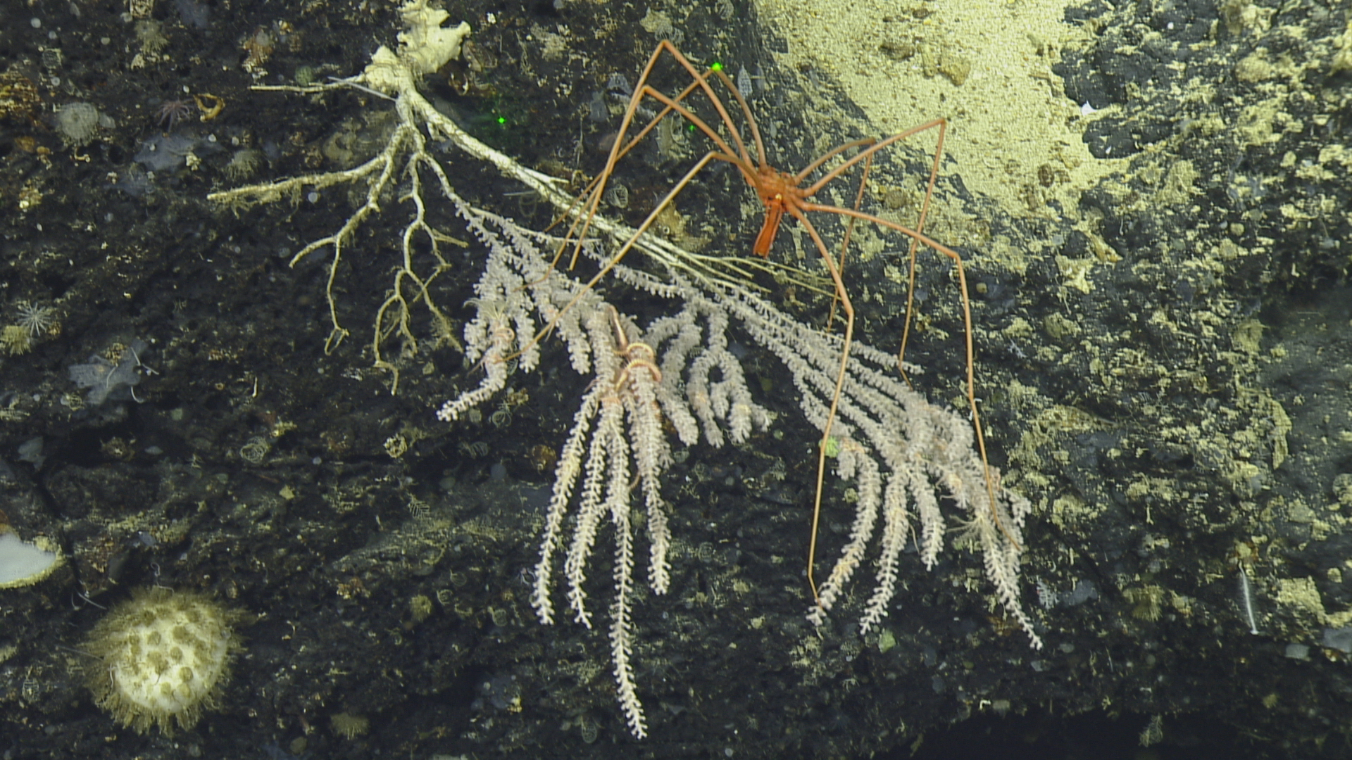
The waters around Palau host a range of fascinating geology, biology, and oceanography. However, despite the rich diversity of life and habitats that are found in the region, very little is known about deep waters in the area.
Building onto NOAA-sponsored work conducted by the Ocean Exploration Cooperative Institute on Exploration Vessel Nautilus in 2024, these three expeditions on Okeanos Explorer will include 24-hour-a-day using the ship’s deepwater mapping systems, expendable bathythermographs (XBTs), and conductivity, temperature, depth profiler (CTD) casts to collect seafloor and water column sonar data as well as collect water samples for environmental DNA (eDNA) analysis. This work is being conducted in partnership with Palau to expand what is known about the deep ocean around Palau.
The first expedition will focus on collecting mapping data and eDNA samples to the west and south of Koror, Palau, in the area around southwest islands that make up the states of Sonsoroal and Hatohobie. This area is characterized by strong surface currents and seamounts that have formed near the boundaries of the Palau Basin and the Caroline Plate. Work on the second expedition will occur to the north and east of Babeldaob, focusing on closing bathymetery gaps along the Palau Trench and the Kyushu-Palau Ridge. The second expedition will end in Guam. The last dedicated Palau mapping expedition will start in Guam and will focus on expanding high-resolution bathymetry coverage around Babeldaob. This expedition will also include the collection of eDNA samples from several of PICRCs long-term eDNA monitoring stations.
All data collected during the two expeditions in and around Johnston Atoll will contribute to Beyond the Blue: Illuminating the Pacific, an ocean exploration campaign designed to raise collective knowledge, understanding, and appreciation of coastal and ocean waters in the Pacific Islands region through coordinated mapping and exploration expeditions, data management and sharing, strategic partnerships, and outreach and engagement.
The expeditions are being planned and led in close partnership with PICRC, with junior and senior regional advisors actively engaged and providing input both on shore and at sea, working to further build bridges between the two counties and share experiences.
Meet the Explorers
Naming every participant in a telepresence-enabled expedition is next to impossible, as scientists from around the world have provided input into the expedition plan. However, we've gathered information about the members of the team who are sailing on the ship and participating in the expedition from sea - meet the team!

Sam Cuellar
Expedition Coordinator
NOAA Ocean Exploration

Logan Kline
Operations Support Analyst
NOAA Ocean Exploration

Sean Maluchluw
Junior Regional Advisor
Guest Scientist

Jessica Nation
Multibeam Bathymetry Data Manager
NOAA's National Centers for Environmental Information

Christopher Romsos
Datapresence Systems Engineer
Regional Class Research Vessel Project, Oregon State University
Education Content
Education theme pages provide the best of what the NOAA Ocean Exploration website has to offer to support educators in the classroom during this expedition. Each theme page includes expedition features, lessons, multimedia, career information, and associated past expeditions.


Related Links
Expeditions
- NOAA Ship Okeanos Explorer: Beyond the Blue: Illuminating the Pacific
- Lebuu's Voyage I - Palau
- Lebuu's Voyage II - Palau
- Mapping and Water Column Exploration Offshore Palau
Technology
Partners
Media Contacts
Emily Crum
Communications Specialist
NOAA Ocean Exploration
ocean-explore-comms@noaa.gov
Keeley Belva
Public Affairs Officer
NOAA Office of Marine and Aviation Operations
keeley.belva@noaa.gov
For more information, visit the Beyond the Blue Media Resources page.
Data collected during all expeditions will be available in NOAA’s public data archives within 90-120 days of its completion and will be accessible via the NOAA Ocean Exploration Data Atlas.
Published July 17, 2025