Mapping Day
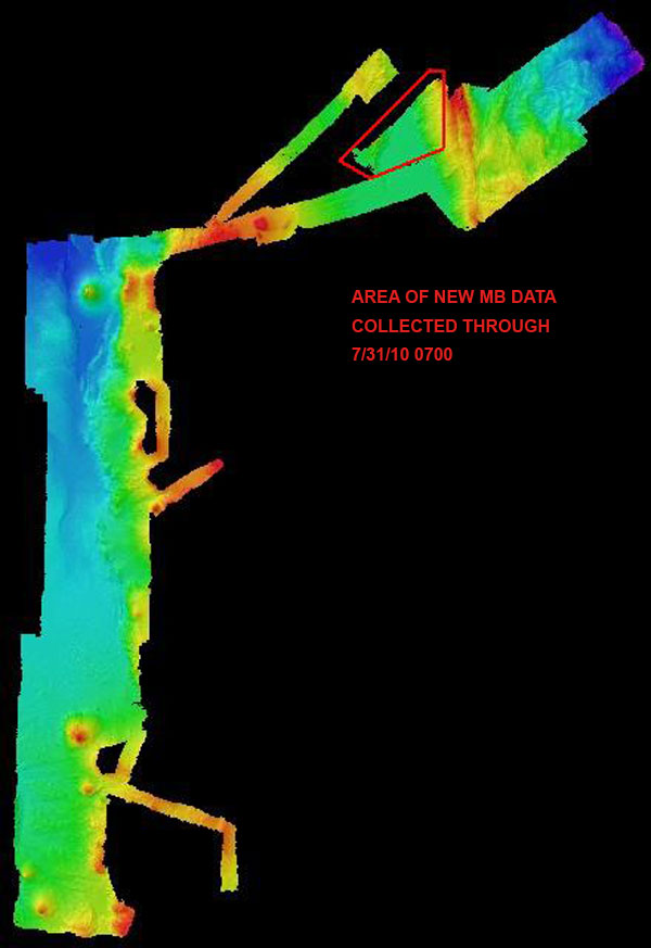
Image courtesy of the NOAA Office of Ocean Exploration and Research, INDEX-SATAL 2010.
Download larger version (jpg, 61 KB).
Bathymetric map showing the high-resolution multibeam data acquired by
Okeanos Explorer
so far during the INDEX 2010 Expedition. The red polygon shows the area mapped on July 31.
Learn more
